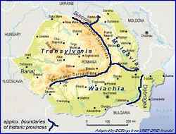
 Romania was divided for many centuries into provinces and which were first united into a single state in 1918. The small map shows the historical borders between the provinces. See the
historical maps for a review of the territorial changes over the centuries.
Romania was divided for many centuries into provinces and which were first united into a single state in 1918. The small map shows the historical borders between the provinces. See the
historical maps for a review of the territorial changes over the centuries.
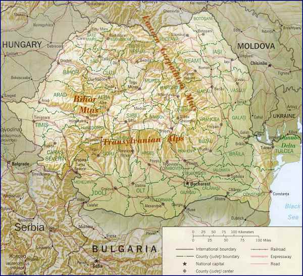
This map has been adapted by B. C. Biega from a map in the public domain at the
University of Texas at Austin
Perry-Castañeda Library Map Collection.
Return to Maps Index page.
or return to Home page.